
Mile 3650. Watson Lake, Yukon Territory. Day 21. Sunrise 4:11am, sunset 11:01pm.
Hello? Is the world still out there? We’ve been 48 hours without any coverage whatsoever. Mark didn’t care, but I had a difficult time settling without it.
We arrived in Dawson Creek BC (not of television series fame), Mile 0 of The Alaska Highway, on June 22nd, a beautiful warm sunny day. For a brief history of the highway read the beginning of my 9000 Mile post. I need a geography lesson. I thought we escaped the Rockies when we high tailed it out of Jasper National Park, but then I read that Dawson Creek has an annual snowfall of 72” with an average depth of snow midwinter at 19.7” and 100 frost free days per year. It’s deceiving because Dawson Creek doesn’t have that mountain feeling. Turns out it’s in the highland region of the Rockies. I learned that from an old-fashioned accordian fold map.
Despite the beautiful stay at Mile 0 rain has dogged us. The day we left Dawson Creek we pushed further north than planned trying to escape it. The surface of a gas station we stopped at wasn’t finished with anything, just dirt, and rain had turned it into one big muddy mess. The owners probably figure why bother, it’s too much work and money to maintain anything else in country that sees so few frost free days. But it was enough to motivate us to bypass campgrounds on our list similarly surfaced. Neither of us wanted to camp in steady rain after Jasper. That experience lingered longer than it should have with the discovery of a leak in the back of one of the clothes closets. Fortunately Mark isolated it to an external light at the front of the trailer and sealed it up good. The rains since then have confirmed it no longer leaks. Now we wait for it to dry out and in the meantime share a closet. Anyway, we kept driving north to Fort Nelson, the unofficial Mile 0 (it’s where new construction on the highway began), and to partially sunny skies.
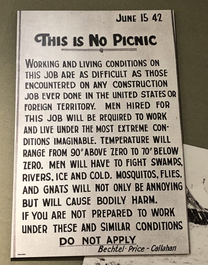
Many of the small towns along this stretch of the highway are more than 200 miles apart. They started as forts by fur trappers. Some had no connection with the outside world until 1942 when they were repurposed for the building of The Alaska Highway and the war effort. The discovery of natural oil and gas fields in the 50s and beyond grew the towns further. Fort St. John quickly became the oil capital of British Columbia and Fort Nelson contains the largest natural gas processing plant. This history is not obvious because by all appearances there is nothing out here but trees and there is no sign (from the road) of land being used for this purpose.
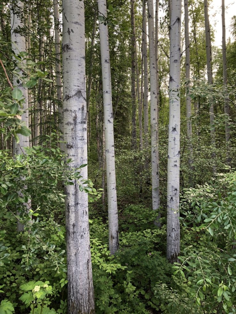
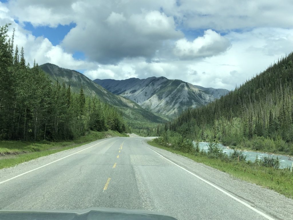
Between towns the “highway” is two lanes. A ribbon of mountain grass separates the “highway” from a thick forrest of aspen, white spruce, and other trees and plants I cannot name. It would be easy to get lost in these woods as the vegetation blocks much of the sunlight. The road fades off into the horizon. Once in awhile there is a break in the trees providing access to well hidden fishing lakes, provincial parks, gas wells, work camps, logging sites, or processing plants.


We try to imagine what it would’ve been like in 1942 crowded in by all this vegetation. There is no sight line without climbing a tree. Bulldozers were used to mow down trees and create a path.

Parts of the highway have been rerouted since then. Over time we’ve learned to deal with challenges the Army faced; sections winding for no reason other than to avoid muskeg (swamp/bog of decayed plant material) have been relocated and replaced, for example.
Black bear, deer, bison, and caribou graze in the grasses off the side of the road. Stone sheep, who obtain most of their nutrients from licking rocks, think the highway is one big rock and become road hazards – chaos for the three cars on the road. All of these we have seen from our car in the last few days.


From Fort Nelson we pushed onward to Liard River Hot Springs – a spot in the middle of nowhere. We lost cell coverage soon after leaving Fort Nelson and the location of the springs make Wifi a virtual impossibility. But many websites and related blogs declare Liard the number one spot on The Alaska Highway and thus the reason for our two night stay here. It’s the second largest known thermal spring complex in Canada, with six springs feeding into different pools and streams that drain into a marsh. It’s even popular amongst the locals. Our mid-afternoon arrival was not early enough to secure a site in the campground proper, the location of the hot springs, so we camped the first night across the street in what’s referred to as “overflow”, a large gravel lot with no amenities, not even picnic tables. The second morning most of the campers in overflow drove over to vacated spots in the actual campground. This will no doubt be our shortest travel day, barely a thousand yards.
The woods around us continue to be thick. The hot springs are surrounded by almost tropical foliage. Our neighbor at our Fort Nelson campsite told us about several Grizzly Bear attacks many years ago at Liard. One attack occurred on the boardwalk leading to the springs (about a 10 min walk) and in another instance a grizzly wouldn’t let a couple out of the pool. A ranger had to be called. Our neighbor then when on to explain it’s probably not an issue now. Back then they had just closed a nearby dump that the bears apparently depended on. But still, it’s hard not to let the story get to you. I kept expecting a Grizzly to walk out of the woods behind our trailer. One didn’t, but we did see Moose feeding along the swamps the path to the hot springs meander through.


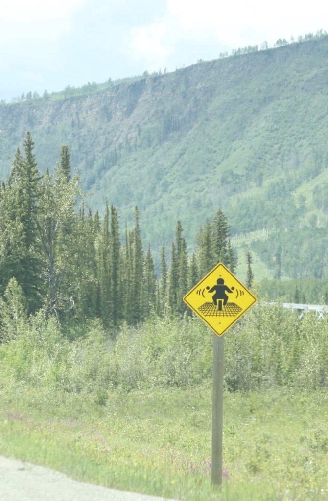
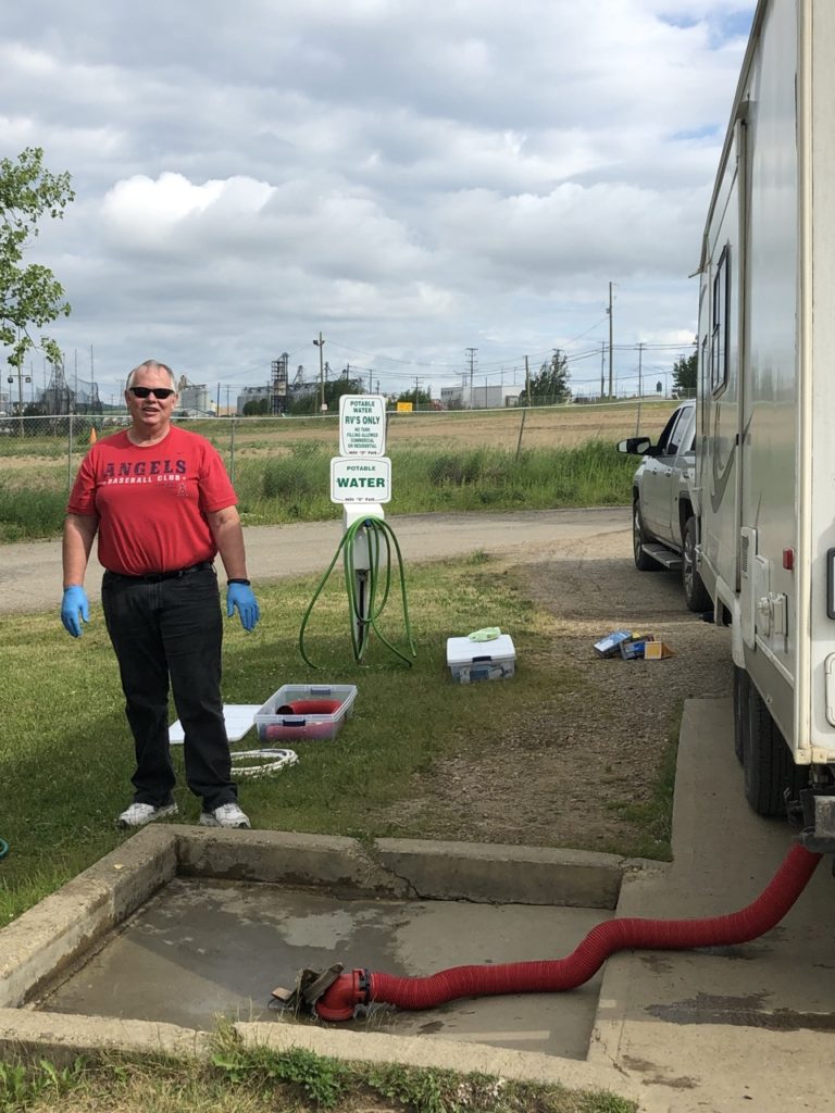
We continue to enjoy the signage here in British Columbia. Except in a few cases they seem to prefer pictures over words which makes some of the signs challenging to decipher (avalanche area) and others humorous (motorcycle ride over bridge made of metal grating will cause the motorcycle to vibrate). The government is not the only author of signs. Here’s another “it goes without saying” sign in a private campground. It’s at the Sani Dump and is instructing users of the dump to use a hose. Frankly, I don’t want to think about the alternative.


8 comments
Sorry, but I just had to laugh about you two sharing a closet til things dry out — seeing that your closet in the trailer is only about 10″ wide.
I know. The closet is the one thing in this trailer that drives me absolutely batty!
Are you sick of trees yet? 🌲🌲🌲🌲🌲🌲🌲
Can you ever really be sick of trees? The variety of vegetation keeps it interesting, that and keeping eyes peeled for wildlife on the side of the road.
Did you take a dip in the springs?
Yes. It was lovely the first time. You really got the sense of of this natural wonder in the middle of nowhere and there was hardly anyone there. Felt more like a pool at the Hampton Inn the second time with kids, pool noodles, frisbees.
Lauran… wow 😮. I think I would need a chin strap cuz my mouth would be always open saying wow. THe scenery is incredible!! Lol I tried tapping the pics to make them bigger.. your sign pics are kinda funny…. and those blue gloves… we have those on our boat! Thanks again for sharing so much good stuff with us… till next time. Safe travels dear friends. 😘🌏
It is jaw dropping wow. Wait until I post some of the animal pics. I made a change to the photo size hoping that makes the images a little larger to enjoy.